18 October 2012

Day 97: Ocracoke, Outer Banks – 18/10/12

Last night we decided to stay another day here for a chance to relax again after the bridge trauma yesterday.  Having celebrated our victory in getting under the bridge last night with a cheap bottle of SB, the resulting headaches convince me never to drink cheap wine again and just stick to the good stuff!

I have an extra long lie in bed then get myself together.  Mike has already been out paying our dock fees into the honesty box just behind us.  There has been a dock master of sorts coming and going to the little hut but no one has been to ask us for money.  Relying on just plain old honesty is rather a nice way of doing it.

We all go out to explore the island a little, all 15 by 1 miles of it.  The others want to hire bicycles again but I am not so sure – I’m not exactly safe on two wheels and am worried that it might not be good for my back.  I would prefer to walk although the sun is quite hot.  In the end we hire a golf cart for the four of us which works well, Mike and Bob in the front and Maggie and I in the rear facing backwards, which I have to say feels a little strange.

We poodle off to visit the British cemetery first.  In 1942 the armed trawler, the Bedfordshire, which had been lent to the US to protect their shipping lanes which were being attacked by German U-boats.  She was torpedoed herself just off the Outer Banks and all hands were lost.  Only four bodies were recovered and only two of those were identified.  It was actually to protect shipping that the Intracoastal Waterway was developed, so that ships could carry on unimpeded by the best efforts of the Germans to destroy them.  From the cemetery we head to the Ocracoke lighthouse which stands inland but is still working. 

P1130061 P1130063 Photos:  The Ocracoke lighthouse

We then go on a hairy drive down the beach, not strictly allowed (we discover later that you should have an off road licence for the beach and they don’t give those to golf cart drivers).  Bob has read that the beach at Ocracoke is the top beach in the US.  I think he is seriously misinformed.

It is a bit wild and a bit lovely in a way but I am expecting white sand and sand dunes that go for miles.  The sand is a very dark yellow and hard packed after all the rain last night and the sand dunes are one dune thick.  Basically it’s somewhere to take your car and cast a fishing line, all 15 miles of it.  It isn’t the mix of Whitehaven Beach on Whitsunday Island and Wildernis beach in South Africa but driving full pelt in a golf buggy getting incredulous looks from the locals is fun all the same!

P1130028 P1130071 P1130077  Photos:  The Atlantic side of the Outer Banks at Ocracoke 

Next it’s lunchtime and we hit Howard’s Pub where the list of ales available is three times as long as the menu.  I order a ‘smothered and covered’ burger (one covered with onions, mushrooms and cheese) and hush puppies (fried dough balls).  Absolutely delicious.

Leaving the pub we find a shell shop and I happily choose some lovely examples for my bathroom while Mike and Bob sit on the rocking chairs on the porch like a couple of old men chewing the cud.

We drive around nearly every road on the island to get a feel of it.  It’s quite lovely really, very unspoiled and untouched by the 21st century, feeling like somewhere from the 60’s.  There is almost a hippy feel to it in some ways.

P1130093 Photo:  Mike asleep in the golf cart as the rest of us shop

The day started out hot and bright but by the time we have to return the cart the sky has darkened and it looks like the impending cold front is about to arrive.  Dark clouds roll in from the mainland but in their gaps is yet another beautiful sunset.  I dash out to the marshes with my camera.  While I am there I see both the ferry and the dredger come back for the night.  Later I find out that they collided when they were out at sea.

P1130098 P1130124P1130119 Photos:  Things that go bump in the sunset

We spend the night aboard alone.  We are all tired and need an early night.  We have many miles tomorrow and the forecast is not good.  It looks like we will be beating straight into the wind – just the ticket.


Position:  35 deg 06 min N, 75 deg 59 min W

Distance so far:  2985 miles

17 October 2012

Day 96: Roanoke Island to Ocracoke, Outer Banks – 17/10/12

We are all up at first light but we have hang around until it is actually light enough to see the channel markers clearly.  It’s a beautiful sunrise which greets us but it does nothing to lift our spirits or make us dread the next hour any less.  With Silver Moon ahead of us trying to work out how much headroom they have and our antennae sticking forward to try to give us a little advance warning if there’s not enough, we set off, retracing our path out of Shallowbag Bay.  We leave our fenders on as there are steep wooden pilings around the bridge supports and if we are going to drift through under very little power, we could just drift into them.

P1130019 P1130025 P1130027 Photos:  Beauty and trepidation

As we motor out into the channel, four monohulls pull out ahead of us.  We wait for them to pass then turn right out of the channel into the one leading to the Washington Baum Bridge.  As we get closer a monohull pulls into the channel behind us followed by two sports fishing boats.  The last thing we want is boats on our tail so I try to call them on all the frequently used channels to ask them to hold back and let us go through.  No one answers.  Terrific.  I call and call and then slipping around the channels I hear one of them talking and using their boat name.  When I call them by name they answer and agree to hold back.

Silver Moon goes through, Maggie trying to see just how much room there is over the top of their mast but it’s impossible.  You look like you are going to hit even when you have loads of room.

The tide boards are present at the bridge.  The watermark lines up with the 65 foot mark.  We should be OK?  But then we thought that last time.

As we approach I can see loads of early morning fishermen on the bridge support next to where we are heading.  Brilliant.  We could have an audience – it just gets worse and worse.

Mike puts the engines into reverse to stop the boat then puts them just into forward gear to get us moving again.  I stand at the back of the boat watching the forward pointing antennae, ready to dash under the protection of the steel framed bimini if the worst happens.  We glide forwards and slightly sideways towards the bridge.  Neither of us talk.  I watch the antennae slip under the edge, then the mast, and slowly, ever so slowly, we slip underneath.

I cannot explain the feeling as the mast slid out from under the far side of the bridge.  Mike leaps out from the helm seat punching the sky.  I turn to Mike.  “I feel sick” I say.  “So do I” he says.  We both realise we have been holding our breaths.  I start to cry.  Over the radio Maggie and Bob are whooping with relief.  They have slowed down and pulled over to watch our ordeal, feeling it almost as much as we do.

The boats behind overtake us, I get Mike his breakfast, we both take painkillers for the headaches that immediately flare up with the relief of getting through unscathed and we settle down for the journey to Ocracoke Island, part of the Outer Banks.

For a very short while we are able to motor sail but the wind dies during the late morning and the going is slow.  It’s late in the afternoon when we eventually turn into the channel for the only town on the island and in the channel is a dredger.  Bob asks the captain which side he wants us to pass on and he replies “port”.  Now given that a dredger has no discernable front or back (to us anyway) it’s very hard to work out which way it is facing and they are almost stationery when dredging.  Eventually he tells us to go on the green side.

P1130031 Photo:  When they’re this much bigger than you, you give way

Passing the dredger, we get the whiff of something unpleasant.  At first we think it’s fish but then Mike realises that they are literally building an island with all the stuff they are dredging up, and this little island is completely covered with sea birds, and what do they do all day?  Eat and poop.

P1130032 Photo:  Seagull island

Having got past the dredger, we get the car ferry – it’s all go at Ocracoke! 

P1130035 Photo:  And then we move again

Eventually though we manage to get into Silver Lake, the rather nice inlet where we hope to stay the night.  Unfortunately the dredging equipment has taken over half the anchorage and after motoring all around, Mike decides there just isn’t enough room for the two of us to anchor and heads for the town dock.  We’ll just have to pay!

P1130039 P1130040 Photos:  Silver Lake, Ocracoke

There are plenty of people who come to help us tie our lines and over the next few hours many more people come over to see the two huge cats moored in their little town.  They really are very friendly.

We are treated to a wonderful sunset then Maggie and Bob come over for dinner.  Maggie tells me how she had been crying with relief when Jeannius emerged from under the bridge and we down a bottle of rather cheap SB to celebrate.

P1130042 P1130043 P1130049 Photos:  Sunset over Pamlico Sound


Position:  35 deg 06 min N, 75 deg 59 min W

Distance so far:  2985 miles

16 October 2012

Day 95: Manteo, Roanoke Island – 16/10/12

The weather was as predicted during the night – very high winds funnel through the marina and it pours with rain just like in the tropics.  Bob knocks on our boat at around 2 am and tells us our bow is swinging out and Mike has to put another line on to hold it tight.

By the morning the rain has cleared leaving a much fresher day with a nip in the air but a wonderful blue sky.

We have been told by Rita that the best blueberry pancakes in the world are available at the top of the road at Darrell’s Family Diner, so we all trundle off their before they stop serving.

Rita is probably right.  I ask the waitress how big they are, expecting Scotch pancake-size (about 4 inches across).  Her hands show me a diameter more than twice that and I change my order from 3 to 2.  It’s a good job I do.  They arrive with half a ton of Maine blueberries and an enormous dollop of butter on top.  They are so sweet and full of flavour that I hardly put any maple syrup on.

P1130015 Photo:  Heavenly blueberry pancakes

Waddling back to the boat I decide that today is a day for me to clean the boat (and work some of the pancakes off), do some sewing, dye my hair and cut it and do some blogging.  I end up doing none of these but instead go out with Rita in her beautiful Mazda MX5 with its convertible hard top.

I had expressed interest in it yesterday as Mike has promised me a new car when we get home.  Every time I look at mine now something goes wrong – a bit like a boat really!  Anyway, Rita said I could take it for a spin.  I refuse at first (I am quite happy to drive a hire car here because no one gets upset if you prang it but I am terrified of harming someone’s pride and joy), but Rita is adamant, and once she has me sitting in it she throws me the keys and gets in.  So while the other three are healthily riding bicycles around the island, I am zipping (zipping slowly anyway) around town in her Velocity Red car.  Apart from hitting the door a couple of times when I reach for the gear stick (on the wrong side) I manage to do nothing worse that shoot through a muddy puddle.

IMG_2441 Photo:  Oh how I want one of these!

By the time Mike comes back, with legs of jelly from the unaccustomed exercise I am looking up prices on the internet for the car and have only managed to put one load of washing on.

Not only has Mike been exercising, but he has visited the bridge to see if the tide boards are visible but was unable to see them.  He and Bob had then continued on to the factory where Gunboat are being built.  These catamarans are made entirely out of carbon fibre, cost over a million dollars and go like the clappers.  Not for me.  I just want a Mazda MX5!

Stripers offer half price steamed snow crab and shrimp at happy hour so we decide to have an early dinner there.  I have half and half and although it’s very nice, it’s not very filling so I end up having a bowl of soup as well.  So does Maggie and so does Bob except he goes one further and adds a fish sandwich to his food order.  He should have known that it would contain half a ton of flounder!

P1130018 Photo:  I had to use wide angle to get the crab legs in!

In the early evening I continue to traipse from the boat to the laundry and when it is done, I do my hair.  Because we are using the showers at the marina (lots of lovely hot water) I have to cover my head with cling film then a towel to scuttle across there when I have finished, praying that I won’t bump into anyone.  Maggie and Bob in the meantime have taken themselves off to the clubhouse lounge where they watch the presidential debate on the TV.  Having had my fill of someone’s political opinions across the bar over dinner, I keep well away, just popping up to say goodnight to them.

Tomorrow we face the bridge.  Thank goodness the wind has dropped.


Position:  35 deg 54 min N, 75 deg 39 min W

Distance so far:  2923 miles

15 October 2012

Day 94: Northwest Point to Manteo, Roanoke Island – 15/10/12

We only have 9 miles to go today to the little town of Manteo on Shallowbag Bay but even armed with the information on the new charts, it’s a little scary.

We motor off at around 8 am needing to arrive in the shallowest parts of the channel at high tide just in case.  The tides only make around a foot of difference to the depth but that could be all the difference we need.  The guide itself shows just 4 foot of water in the channel but talks about a ferry which draws 8 foot regularly going in and out.  With such conflicting information it can be really difficult to make an informed decision and it’s just as well that Mike found the Corp of Engineers stuff on the internet as they have failed to answer either of my two e-mails.

Maggie and Bob go ahead of us.  They draw a foot less than us and keep us informed of the depths as we go.  We follow very closely in their footprints around the island and then into the channel on the east coast of the island.  We slow right down.  If we are going to run aground we want to do it slowly and gently!

IMG_2423 IMG_2426 Photos:  Following Silver Moon’s wake into Shallowbag Bay

IMG_2427 Photo:  In the distance is the bridge that we have to get under

Bob manages to raise someone of the VHF who gives precise information about entering Shallowbag Bay.  “Go right at channel marker 30a as if you want to run into it then turn right and stay on the left of the channel as there’s only 2 foot of water on the right”.  Although the normal practise in a narrow, shallow channel is to go straight down the middle we bend to local knowledge and follow his advice.  We have no problem and turn into the wonderful Shallowbag Bay Marina.

This marina, taken over by new management last November has to be the friendliest we have visited so far and with the facilities it has to offer, one of the best value.  It offers fuel, water, electricity, showers, toilets, swimming pool, jacuzzi, on-site restaurant and bar and a clubhouse for the condo residents that visiting yachts can use.  The clubhouse has a full fitness suite, pool table and a lounge with TV and book lending library.  From the moment we arrive, Rita, the owner, is there to help with a winning smile and friendly manner.

We also meet Archie, or Capt’n Parkie as he is usually known, a colourful character from Manchester who lives on the boat docked just behind us, a lovely fellow who’s ready with stories of the open ocean, his adventures and the wives he parted company with along the way!

While Bob sets to cleaning Silver Moon and Maggie does her computer stuff, Mike and I decide to go and explore and find the lay of the land.  We walk into town, Manteo, along the main road then along the coastal boardwalk.  It is so pretty.  Marsh land creeps down to the sea where we pass and we can hear ducks quacking in the long grasses.  Everyone we pass says hello.  This is North Carolina hospitality and I like it.

P1120992 P1120993 P1120994 Photos:  Along the boardwalk to Manteo

In town we visit a shell shop that has the most exquisite specimens (I mean to go back but get sidetracked) and witness a wedding that is taking place on the dock.  A weather tower shows the sea level that Hurricane Irene caused to rise – 11 feet according to the marker.

On the way back we check out the restaurants.  We are not looking for fine dining here just some good value Southern fare.  However, near the marina we find a shop selling nothing but pumpkins and on the opposite side of the road are some bulls.  Yes, bullocks.  Not tethered.  In a field alongside a main road with nothing but a 2-foot high electric fence.  I ask you!  If that bull ran into it, I'm sure it would feel like a little bee sting!

P1130008 P1130007 Photos:  Along the main road

As for the pumpkin stall, I have been really surprised at just how all consuming the Halloween thing is.  Preparations seem to have been going on for well over a month already.  Sales of plastic spiders, skulls, costumes, masks, fake webs and all the rest of the paraphernalia is abundant.  Houses are decorated outside seemingly far more than they are at Christmas.  Seems weird to me.

P1130016 Photo:  View from the Clubhouse at Shallowbag Bay Marina

P1120990 Photo:  Entrance to the marina

Walking past Silver Moon which is now gleaming like a very shiny new pin, Bob having spent all afternoon cleaning it, we arrange to meet at Stripers, the on-site restaurant, for dinner, not to be confused with a strip club which is what I thought it was when I first saw the name!

Halloween decorations are going up in the bar when we arrive, and instead of going up to the restaurant on the first floor, we hug the bar on the ground.  The food portions are enormous – and good.  Both Mike and Bob realise their eyes are bigger than their bellies when they see the size of their seafood platters.  I settle for seared tuna topped with lump crab and wasabi alioli.  Yummy.  Maggie is a good girl and goes for tuna carpaccio and salad until she sees how huge that is too.

IMG_2428 Photo:  Maggie’s lite bite!

P1130014 Photo:  Mike and Bob will need from poor Yorick before they can eat this lot

We heave our bellies back to our boats.  We have decided to stay another day to get some jobs done, do a bit more sightseeing and see if we can get any more information on that bridge.  The weather is predicted to be stormy during the night and we are told that the strong northerly winds will literally shift a bit of water out of the bay giving us a little more room underneath it.  I hope so.


Position:  35 deg 54 min N, 75 deg 39 min W

Distance so far:  2923 miles

14 October 2012

Day 93: Elizabeth City to Roanoke Island – 14/10/12

By 8.30 am Mike and Bob are gathering together their tools for the morning’s investigation, including the all important very long length of line for measuring the height of the two masts.

Mike winches Bob up our mast first.  Once at the top he removes the antennae which is hanging straight down (we never did know what that did) and points the other one forward and ever so slightly up then tapes it into position there.  He removes the wind vane which amazingly still appears to work but is hanging precariously and is better off than on for the time being.  He then tapes up all the electrical bits to protect them until we get new lights etc.

P1120983 Photo:  Bob waves from the top of our mast

He then drops the line to Mike and I stand at a distance checking that the line is straight down.  Once Bob is back down they measure a horizontal line from the top of the coach roof where the line met to the nicely positioned piling by the side of the boat while I again stand at a distance and check that it is truly horizontal.  From that mark on the piling they measure to the water.  That is the total measurement, give or take a few inches.  She measures a few inches under 65 feet.  Our antennae were at least 3 feet.  How did we fit under the first two bridges?  It’s impossible.  They measure again but it’s virtually the same.  This is more than the designers’ website gives for the boat (63 feet).  The 64-foot bridge route is definitely out!

Measuring the height of Silver Moon’s mast the same way, Bob finds out that he is actually lower than he thought - 62 feet.

Mike and I spend some more time on the internet trying to find the depths along the channels that we will need to travel to avoid the aforementioned bridge and remove the necessity for backtracking all the way back to Norfolk.  Eventually we find a website that shows the dredging that was done in the channel earlier this year by the US Army Corp of Engineers and it shows more water than any of the charts or the ICW Waterway Guide.  I fire off a couple of e-mails to them hoping for clarification but we slowly come to the decision that coming to a stop in shallow water on soft sand is preferable to hitting a concrete bridge and that we will therefore carry on to Roanoke Island.

It’s late when we leave and we have to motor hard to get down the Pasquotank River and into Albermarle Sound.  Once in the Sound, it is so wide that apart from the depth (shallow) you could be in the ocean.  It’s a boring old bit of motoring - one of us, normally Mike, has to sit at the helm because there are pots dotted around – not many but enough to keep you on your toes.  We stop just in front of the highway bridge at Northwest Point on Roanoke Island and put our anchors down.

Mike and I are just getting in the dinghy to go over to Silver Moon when Maggie hears on the radio another large boat captain telling us both to move as we are in the middle of the channel.  What channel?  There is no channel marked on the charts but we move anyway.  Only after our anchors are settled a second time does she realise that the message was not meant for us and that the big boat bearing down on us is actually the lane markers in the middle of the 45-foot bridge just a short distance away!  Oh how we rib her about that!

Dinner aboard Silver Moon is oysters, now thankfully cooked and made into a beautiful chowder by Bob, with parmesan and garlic biscuits from Maggie and salad from me.  Mike gives Bob copies of the updated depth charts from the USA engineers and convinced that we can make it through, we relax and have another lovely evening.


Position:  35 deg 55 min N, 75 deg 44 min W

Distance so far:  2914 miles

13 October 2012

Day 92: The Great Dismal Swamp to Elizabeth City – 13/10/12

We need to be at the South Mills lock for the first opening of the day at 8.30 am and when I am up and ready to go, I realise that we are the last but one boat to leave the dock.  The only one there is the one who made such a mess of docking yesterday – they are probably too embarrassed to show their faces – I would be!

We start off behind the other boats, now last in the little line of ducks instead of being almost at the front.  It is another cold morning but clear and bright.

P1120908  Photo:  Off we go again heading for the next lock

The South Mills lock opens to northbound traffic first at 8.30 am first, followed by southbound traffic.  At this time of year there is very little northbound so we are fairly sure that we will be going through early.  There is a double 65-foot fixed bridge to go under but since we have already been under one of these Mike is unconcerned and approaches it dead centre at our canal cruising speed of 5.8 knots, slowing down a little more just as we arrive. 

IMG_2320 Photo:  The bridges look innocuous enough

We go under the first one with no problem, not even the tinkle of antennae touching concrete but just yards further as we are going under the second one on there is a terrible crashing and scrunching noise followed by the noise of debris hitting the decks and coach roof.  What the f**k?!

We both rush out from under the safety of the bimini to look.  Both of our VHF antennae are broken off, one hanging at an angle to the mast and the other straight down.  Shocked rigid by what has just happened we allow Jeannius to swing out slightly and the mast touches the trees overhead bringing leaves, twigs and little acorns to cascade all over the boat.

P1120910 Photo:  Tree debris litters the decks

Mike straightens the boat up and then comes out to survey the damage again.  “At least it’s not the expensive bit” he says, quickly followed by '”Oh shit, it is!”.  Mike rarely swears, not like his foul-mouthed wife.  He has seen that the wind vane is also hanging down and then we spot bits of our navigation lights.

We continue on, unable to understand what has happened.  How can we go under two 65-foot bridges only to crash into a third just yards from the second one?

Our lovely journey through the Dismal Swamp Canal is now completely ruined.  It had been such a lovely change to go through this sort of water, making us think wistfully of doing some travelling on the French canals.  At least the French don’t have as many cars though – or bridges!

A bit further on, and still angry and upset, the little line of ducks comes to a gentle halt, waiting for the bridge at South Mills to open.  Stopped as they are in the canal, most of the boats start to drift gently sideways across the water, bows and sterns heading deep into the foliage at either side, although thankfully not into the mud.  While we wait we hear different people talking on their radios – most have had ‘altercations’ with trees and branches (one removed a three–inch thick branch from one tree with it’s mast and stays) and most are covered with leaves and twigs like we are (and worse) but we are the only one to argue, and lose, to a bridge, not surprising as we have the tallest mast in our little convoy.

P1120911 Photo:  Waiting for the bridge to open
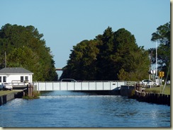
P1120915 Photo:  As soon as the bridge closes, the traffic flows once more

We wait for 15 minutes or so and then the bridge is opened for us.  By the time we arrive at the lock just a few hundred yards on, the gate is open and the boats are piling in and tying up.
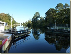
P1120917 P1120919 Photos:  In the South Mills lock

This time we are lowered 8 feet and there is much less tension on the lines as the boats don’t try to swing out.

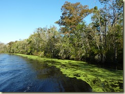
We continue our journey, the canal taking on a different turn after about 10 miles.  It widens out and meanders like the river it has now become – the Pasquotank River in fact.  The surface of the water is covered with a thick, green algae and being the last in the line of ducks we just follow the clear line straight down the middle which has been made by the previous boats. 
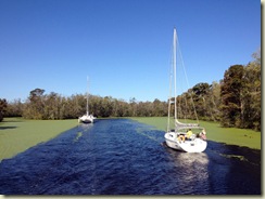
IMG_2381 P1120929 P1120931 P1120942 Photos:  Sailing through an emerald sea

Silver Moon, who had emerged from the lock ahead of us, pulls into one of the many widenings and waits for us to catch up, and we continue towards Elizabeth city together, going through another two bridges (thankfully opening ones – I don’t think our nerves could take another fixed one today) before arriving at the town dock.

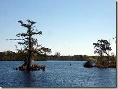
IMG_2396 P1120966 P1120968 Photos:  Coming through the Pasquotank River to Elizabeth City – and more bridges!

Elizabeth City offers free docking on the town dock for 48 hours to transient yachts.  Unfortunately, they do not have room for catamarans so we continue on a couple of hundred yards towards a wall with cleats that already has one small yacht tied against it.  After putting out all our lines and fenders Bob notices a sign saying ‘No docking’ but on closer inspection, Mike realises that it actually says ‘On docking’.  We decide to take their spelling error to our advantage, throw the lines to helpful members of the public and tie up.  This takes quite a while as the dock wall has pillars placed at regular intervals rather than having a fixed edge, and we have to jiggle horizontal fenders around until they rest in just the right place to protect the boats.

IMG_2405 Photo:  Tying up at the town dock

Getting off is interesting and involves climbing up onto a 9-inch wide piling then walking across a 4-foot gangplank before scrambling over a fence.  Not for the faint hearted and only to be done when sober!

We stand at a distance – me, Mike, Maggie and Bob – and survey the damage to Jeannius.  Our mast with all it’s add-ons should have been able to fit under a 65-foot bridge, and did fit under two.  It’s a complete mystery.

P1120922 Photo:  Poorly sick boat – but thankfully no damage to the mast itself

Maggie and I go off to look at the town and what it has to offer, while we leave Mike and Bob pondering our next move.

The town is pretty in the centre, but as usual, we need to walk out over a mile past the strip malls and fast food joints in order to find a supermarket.  Spotting a Wendy’s, I suggest that we stop as I have never sampled their ‘delights’.  A junior baconburger and cheese and chilli fries later, I declare it sampled and have no need to try again.  I would like to say it is gross but it isn’t.  It’s just that that particular culinary delight is now crossed off my list of things to try!

IMG_2411 Photo:  Proof I ate at Wendys!

We find the supermarket, rather basic, do our little bit of shopping and make our way back.  I find Mike in a somewhat desultory mood.  It would appear that we could be stuck between a rock and a hard place as far as the ICW is concerned.  Our charts show us two paths which we could take next.  One has a 64-foot bridge, and if we hit a 65-foot one, we can’t take that route, and the other has depths that, if correct, would leave us beached like a whale.  Our third option is to go back up the Dismal Swamp Canal (now that everything has been removed from the top of our mast, no further damage should occur) all the way to Norfolk, and go around the outside in the Atlantic.

Maggie and Bob have invited us over for supper but neither of us feel like we would be good company.  Then Bob comes up with the idea of climbing our mast and measuring the bloody thing.  Mike has three different heights recorded for it and we need to find out once and for all what it actually is.  Bob is also interested to find out what his mast measures too, so he will go up both in the morning.  Armed with a plan we join them for supper after all, now in slightly improved frames of mind.

Bob has gone out and bought a whole load of oysters and they are there gleaming, in all their shiny, slimy-looking splendour on the table.  Neither Mike nor I like them and when Maggie turns them down as well, he just has to eat the lot himself.  We settle happily on Maggie’s hearty soup, something she had to make because her fridge has a tendency to freeze things as well and the kale was stiff as a board when she checked it earlier!  I know that problem.  Many is the time I have altered our meal plans because of what the fridge has done to my fresh produce!

We don’t stay too late.  There are boats to measure and plans to make in the morning.


Position:  36 deg 17 min N, 76 deg 13 min W

Distance so far:  2881 miles